Minnesota Camping & Hiking

a couple's quest for our favorite hiking & camping spots


Leave a comment

Split Rock River Loop Hike

During a camping trip to Split Rock Lighthouse State Park a few weekends ago, we hiked the Split Rock River Loop. The loop is part of the Superior Hiking Trail and a portion of it is in the state park. The loop is 5 miles if you begin and end at the wayside rest parking lot off Hwy 61.

We hiked up the more difficult west side of the river and back down the easier east side. On the west side, it felt like we were constantly walking uphill and then immediately back down to the river only to go back up again after a few steps. The east side was very flat and easy by comparison. The biggest challenge was running out of water half way through and the water filter not working.

I’ve wanted to do this hike for a while and we had the perfect day for it. It was so beautiful and peaceful and well worth the effort.

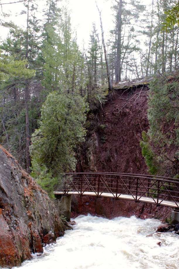
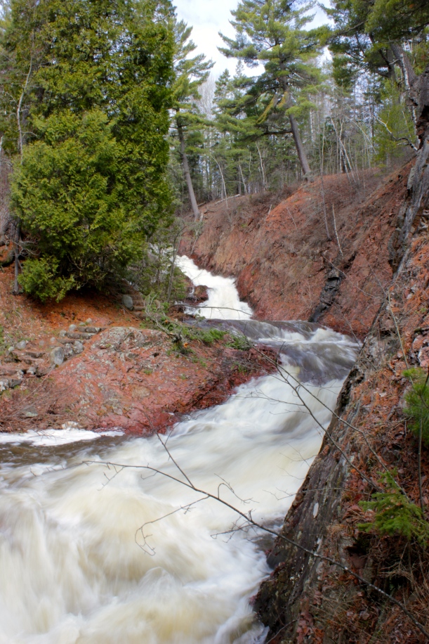
Split Rock River LoopThis bridge and the next two waterfall pictures are just a few minutes past the parking lot. It was so serene and quiet that it felt like we were already far into the hike.

Split Rock River Loop

Split Rock River Loop

Split Rock River Loop

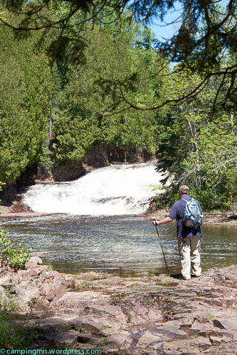
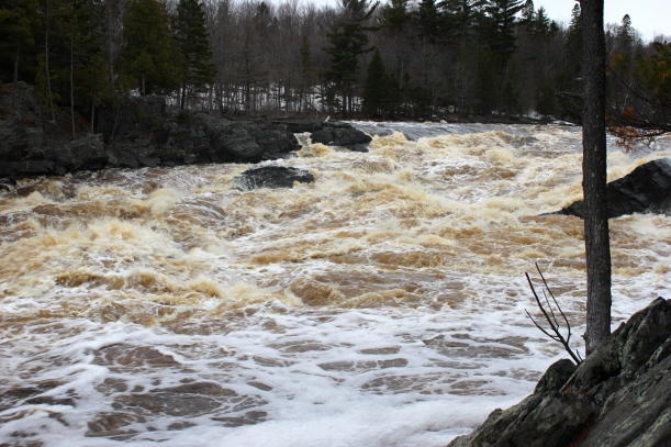
Split Rock River LoopThere are so many waterfalls on the river that we lost count. None of them are on the park map.

Split Rock River Loop

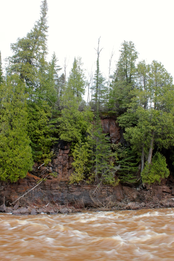
Split Rock River LoopThe way the trees grow out of the rock walls is always fascinating to me.
Split Rock River Loop

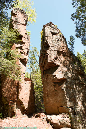
Split Rock River LoopSome people think the river is named Split Rock because of this large rock formation.

Split Rock River Loop

Split Rock River LoopThis bridge marks the half way mark of the loop. It wasn’t as rickety as I expected given the fact that it’s being held in place by ropes attached to a tree and it looks like it could fall over at any moment.

Split Rock River LoopThis is what the trail was like for a good portion of the eastern side of the trail. It was pretty flat, without tree roots or rocks on the trail. There was a long stretch that was very muddy and wet. I didn’t take pictures because I was feeling dehydrated and just wanted to focus on getting back to the car. About 1/2 a mile before the end of the trail, it opened up to an amazing view of Lake Superior.

Split Rock River Loop

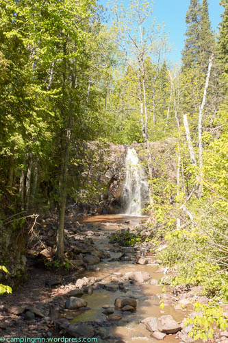
Split Rock River LoopThis trail shelter is perfectly placed at the top of the open hill. After the shelter, you walk down a steep grassy hill to Hwy 61 and back to the parking lot.
Split Rock River Loop


Leave a comment

Wisconsin’s Interstate State Park – Silverbrook Trail Hike

I love a good waterfall and I heard that the waterfall at the end of the Silverbrook Trail is a nice one. The hike was nice but nothing spectacular and the waterfall itself was not all that amazing. Perhaps I was expecting more because that area is so beautiful in general.

Silverbrook Trail starts at the end of the group camp area.  We weren’t completely sure if we were allowed to park there but we did and nobody said anything to us. The first part of the trail is more open and prairie like and was very hot in the sun. After maybe 1/4 mile, there are more trees and shade. I was surprised how flat the trail is, considering how rugged the terrain near the river is.

Interstate State Park Silverbrook Trail


Interstate State Park WI Silverbrook Trail

The park map says the trail follows part of the old road that ran between Osceola and St. Croix Falls and passes an old copper mine area. I wish there were interpretive signs or a better explanation on the map as to the history of the area.

Interstate State Park Copper Mine

Interstate State Park Copper Mine

Shortly after the mine area, you come to the waterfall. It wasn’t very impressive from this vantage point and we were a little too lazy to find a way to the bottom.

IMG_3471

All in all, hiking this trail would be a fine way to spend an hour when you’re bored and have explored everything else in the area. It wasn’t really worth the drive from the Twin Cities, though.

We did have lunch in the picnic area along the river, which was lovely. There are a lot of picnic tables spread out and big open spaces to sit on the ground.


Leave a comment

Jay Cooke State Park Camper Cabin & Hiking in Duluth & Gooseberry Falls

We kicked off our summer early by staying in a caper cabin at Jay Cooke State Park and going on a couple waterfall hikes last weekend. It was a bit cool, very wet and muddy but fun.

When we arrived at the park, we walked around the swinging bridge area. The last time were were there was before the 2012 flood washed the bridge away. I couldn’t believe how different it looks. So many of the trees are gone so now there’s a great view of the bridge and river from the picnic area.

Jay Cooke Swinging Bridge


Upstream from the swinging bridge.

Upstream from the swinging bridge.

We stayed in the camper cabin named “Gabro.” It’s near the walk in campsites at the edge of the regular campground. The cabins are nicely spread out so you have some space. Gabro is somewhat exposed but the picnic table and fire pit are tucked to the side of the cabin which gives some privacy. The cabin has a deck and screened porch, which would be awesome in the summer when the bugs are bad. We thought the cabin was really cozy and clean and I was amazed at how comfortable the mattresses were. There’s a pit toilet and water nearby and the campground restrooms are just a bit further away.

Jay Cooke Camper Cabin - Gabro

Jay Cooke Camper Cabin – Gabro

Saturday, we went hiking in Duluth along Tischer Creek in Congdon Park. We found this trail in Waterfalls of Minnesota’s North Shore by Eve and Gary Wallinga. According to the guide book, it’s about 1.5 miles round trip but it felt a lot further than that. There was a lot of mud, snow and ice that slowed our progress. The falls were impressive with all the snowmelt and rain. There were about 4 or 5 falls total and some pretty bridges crossing over the creek. It’s a really beautiful trail and it felt like it was further north. I would definitely go back.

Directions to the trailhead: From London Road, turn onto 32nd Avenue East, which is just before Glensheen Mansion). This runs into Congdon Park Drive. Follow this across Superior Street. Congdon Park is to your right.

Tischer Creek Duluth

Tischer Creek Duluth

Tischer Creek DuluthThere is an old road that runs parallel to the trail. Our plan was to take that back to our car but the beginning was washed out, we’re assuming from the 2012 flood. We hiked down the trail for a while and then crossed over to the road after the washout area. Here is a picture of the washed out road:


Tischer Creek Duluth

After our hike, we had lunch at one of our favorite places in Duluth – the Duluth Grill. After that, we went to Gooseberry Falls State Park and attempted to hike to Fifth Falls. That did not turn out so well thanks to the snow, ice, mud and my fear of heights. There was a spot in the trail where there was a very steep, long drop to the river and the trail was all ice and mud and running water. We got sooo close that we could see the falls – or what we think were the falls. I wish I could have continued but my legs were feeling too shaky and I couldn’t psych myself up for it.

Gooseberry Falls State Park

Gooseberry Falls State Park

We think Fifth Falls is in the background.

We think that might be the end of Fifth Falls in the background.

Gooseberry Falls State Park

Standing on the bridge under Highway 61, looking towards Lake Superior in the distance.

Standing on the bridge under Highway 61, looking towards Lake Superior in the distance.

We got back to Jay Cooke around 7:00. We were tired so we ate, played a few games of Uno and went to sleep. On Sunday, we went to the Oldenberg Point lookout in the park. The view was incredible.


1 Comment

Geocaching Wild River State Park

We haven’t been geocaching in a while so I loaded the GPS with several caches and we headed out to Wild River state park.

If you haven’t heard of geocaching, it’s essentially a treasure hunt using a GPS. You enter the coordinates into your GPS and find the geocache that’s hidden in that spot. Sometimes the geocache will be a container with little trinkets and a log book that you can sign. Other times, it will be a clue or another set of coordinates that lead you to the next geocache. If you don’t have a GPS, you can borrow one from many of the state parks for free and even take a geocaching 101 class. Geocaching isn’t limited to state parks – there are geocaches hidden all over the world. Here is the website where you can find geocaches near you – or even hide some of your own!

Thankfully it was a beautiful fall day because we hiked much further than we had planned. Our hike took us from the visitor center to the boat launch and canoe rental….

along the River Trail past the Spring Creek backpack/canoe in site…

(The site was down a short spur trail. It is near the river but does not have a view of the river. It has a small dirt tent pad, picnic table, fire ring and toilet hidden behind a wood fence. There were stairs nearby that lead to the river. There is a hand pump and pit toilet by the canoe rental.)

past a little beach area…

(Dog owners: there are no signs prohibiting dogs from using this beach!)

down the River Terrace Loop to the standard state park campground to the amphitheater,

and down the paved Old Logging Trail.